How to use the East Coast Greenway mapping tool
The East Coast Greenway is composed of a 3,000-mile spine route, Key West north to the Canadian border in Maine, along with a number of complementary routes offering additional scenic options in Virginia, Rhode Island to Cape Cod, and in Maine. Please also visit our state page summaries for additional information on the Greenway in each state.
Watch the short video below to learn how to plot a trip on the East Coast Greenway via our web-based mapping tool and then:
-
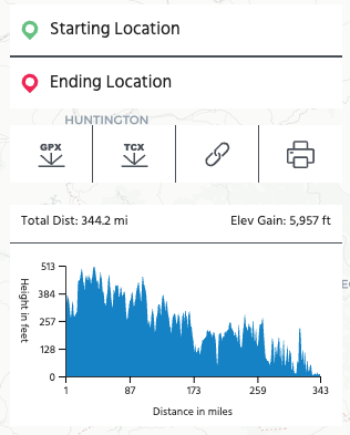
download a tcx file (down arrow in image at right) that you can then upload to Garmin or other device,
-
create a URL to share your route (link icon) with others via email or text,
-
and/or download a PDF of turn-by-turn cue sheets (printer icon) that you can share and print.
Important note: Remember to click "enter" or "return" after typing in your starting and ending locations.
Special note: Depending on the exact location of start/end points selected, the map may provide navigation along the spine route or a complementary route. When choosing beginning and end points, you may need to break the request into smaller segments or nudge your starting or end points to the north or south a bit to receive navigation along the section you are interested in.
For navigation on the go, we recommend using the East Coast Greenway map on a third-party mobile app such as Maps.me or Ride with GPS. Such apps allow you to navigate without needing an Internet connection once you have downloaded maps for the area where you are traveling and you have uploaded the Greenway route file.
Click here to download a KML file of our entire route: https://router.greenway.org/dataquery/routedownload/public/all/kml/
Find our web-based mapping tool at map.greenway.org — or click the button below.

Quick tutorial: How to use our online map tool
East Coast Greenway | Plan Your Trip With Our Mapping Tool

Greenway Guidance
While the East Coast Greenway Alliance is constantly improving the safety of the Greenway route through its advocacy efforts, many of the current on-road connections, including those on the Greenway’s interim routes, have little or no special provisions for bicyclists or pedestrians. Long-distance travel via on-road sections of the Greenway is recommended for experienced cyclists only. Many lengthy traffic-free segments of the Greenway are suitable for families and cyclists, walkers and runners of all ages and abilities.
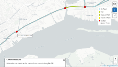
The current on-road routing is housed on low-traffic roads whenever possible. We aim to be as clear as we are able about the conditions riders can expect by including alerts for known stressful sections on our online mapping tool at map.greenway.org as indicated below. Please note that points of caution - indicated by red dots on the map - only appear when zoomed in at the 1-mile scale or closer. You can click on an individual dot to see more caution details.
Directional signage may or may not be present along the route. Users are advised to review state traffic laws, research current road conditions and discuss plans with people familiar with area roadways.
This website provides information for the public about trails and roads for traveling the interim route of the East Coast Greenway and their general suitability for long-distance cycling and walking. The East Coast Greenway Alliance and those involved with the development and publication of this website do not assume any liability for injuries, damage or loss to persons using this information or the routes suggested. People using this information are responsible for their own safety and should take appropriate precautions.

Join the Greenway family
Receive East Coast Greenway news directly in your inbox.
Together, let's grow the Greenway
Recent record-setting funding for design and construction goes directly to building the East Coast Greenway - as it should. The East Coast Greenway Alliance needs your support to continue our advocacy work that is fueling completion of the Greenway. The Alliance has a sustained track record of turning every dollar donated to our nonprofit into $100 in public infrastructure investment. Invest today and support the growth of the East Coast Greenway from Maine to Florida.